Round The World and other travels
A frequent flyer's collection of trip diaries
This is: Round Ireland (2016-20)
The Ring of Kerry
 I
awoke before 7am, but took my time and went down for breakfast
around 8 o'clock. Just as on the previous evening, the Danú
restaurant did not disappoint, and I thoroughly enjoyed my nicely
presented Eggs Benedict. When I set out at 9:15, the weather looked
reasonably promising, although it had obviously been a cold night. Little did I realise at this stage, that in terms of both weather and
sightseeing, today was going to be one of the great highlights of
the trip.
![]()
My objective today was to drive the Ring of Kerry, a 180km circular route around the Iveragh Peninsula using the N70, N71 and N72 roads. As I rarely do anything travel-related in a straightforward and predictable manner, however, I intended to extend my journey by omitting a short stretch of the official route and instead using some promising-looking minor roads to access the west coast of the peninsula, the Kerry Cliffs and Valentia Island. I intended to make the circuit in a clockwise direction. All tour coaches operate counter-clockwise to ensure that they never meet each other face-to-face and therefore never have to pass. That little factoid gives an insight into the nature of some of the roads.
Killarney - Kenmare - Sneem
 |
 |
 |
 |
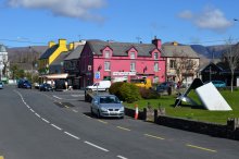
The first section began with backtracking along the final piece of the previous day's journey, which today would be to Kenmare via Ladies View and Moll's Gap. I turned right just before reaching Kenmare, leaving behind the N71 in favour of the N70. Setting the tone for the remainder of the day, I stopped more or less at will whenever a good viewpoint presented itself. My first significant stop was at the colourful little village of Sneem - its unusual name is derived from the Gaelic word for 'knot'.
 |
 |
 |
 |
 |
 |
 |
 |
 |
Sneem - Waterville
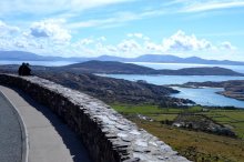
I continued round the official Ring of Kerry route, first southwestwards on the N70 and then northwards on the same road, through Castlecove and Caherdaniel to the village of Waterville. As ever, I stopped where justified by the views and subject to suitable parking opportunities. On this section, the coastal views were both numerous and stunningly beautiful.
 |
 |
 |
 |
 |
 |
 |
 |
 |
Waterville was enjoying some unseasonably warm sunshine when I got there, and a well patronised local café provided the perfect opportunity for my lunch break.
 |
 |
 |
 |
 |
 |
 |
 |
 |
Outside the Ring: to Ballinskelligs and the Kerry Cliffs
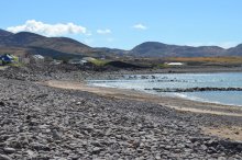
Shortly after leaving Waterville, it was time for me to go 'off-piste': I temporarily abandoned the official Ring of Kerry route on the N70 in favour of a back-road alternative via the peninsula's dramatic west coast.
 |
 |
 |
 |
 |
 |
Portmagee and Knightstown
 |
 |
 |
A little further north and eastwards, I came into the village of Portmagee, where I had time for a brief look around before crossing the Maurice O'Neill Memorial Bridge to Valentia Island.
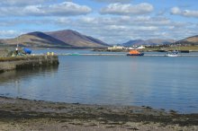
Once across the 1970-built bridge, I drove eastwards to the island's principal settlement of Knightstown (population 156), which looked most attractive in its tranquil setting, soaking up the strong spring sunshine. A little car ferry plied peacefully back and forth between the village and Renard Point on the mainland, hardly making a sound or otherwise disturbing the calm. I learned a little piece of trivia while in Knightstown that I found surprising: lifeboat services in the Republic of Ireland are provided by the British-registered charity, the Royal National Lifeboat Institution.
 |
 |
 |
 |
 |
 |
 |
 |
 |
The first step in completing the remaining part of the route was to take the car ferry across to Renard Point, just a short distance away from an opportunity to rejoin the N70 and the official Ring of Kerry route. It was then an easy run via Killorglin and the N72 back to my base in Killarney.


 After a wonderful day of sightseeing amidst
the most beautiful coastal scenes and charming, remote villages, I enjoyed
another excellent dinner at the Brehon's Danú restaurant,
this time consisting of mushroom soup and 'sticky' beef.
Hopefully I can be forgiven for thinking: Ah, this is the life!
![]()
![]()

