Round The World and other travels
A frequent flyer's collection of trip diaries
This is: Round Ireland (2016-20)
Wind and rain, from Ennis to Galway
 I was on a room-only rate at the Woodstock,
but as the hotel was well outside the centre of town and the charge
for breakfast was only EUR10, the in-house option seemed like a
complete no-brainer. (I could easily have spent a similar amount in
a coffee shop, after wasting time trying to find one.) For the
second day in a row, my explorations began with a very short drive
of around ten minutes: before embarking on the main part of my plan,
I had decided to take a quick look around the centre of Ennis.
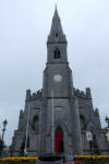
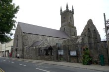
With a population of around 25,000, Ennis is the county town of Co. Clare. It stands on the River Fergus, a tributary of the Shannon. The name derives from the Irish word Inis, meaning 'island', and came about because of a Franciscan friary that was built between two branches of the river. On my short walk, I saw the Cathedral of Sts. Peter & Paul, the town hall, a number of narrow shopping streets, the aforementioned Ennis Friary and - by mistake - the Church of the Immaculate Conception.
As mentioned, a bit of confusion arose over the last two buildings. I asked a local-looking woman if she knew how to get to Ennis Friary, and she kindly said: "Come with me. It's a bit awkward to find, but I'm going right past it." A couple of minutes later, we were there ... sort of. The sign said 'Church of the Immaculate Conception' and I thought: "This looks nothing like what I was expecting." A few minutes later, along the street, I found what I was after - a historic ruin. It turns out that there is a present-day Franciscan community in Ennis, based at the modern church that the helpful woman took me to.
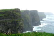
It was now time to get on with the main business of the day, exploring more of the spectacular Atlantic coast of Co. Clare. I knew full well that the weather forecast for the rest of the day was dire, but what can you do? In Ireland, as in Scotland, good weather simply cannot be relied upon. I retraced the final section of Sunday's drive to Ennistimon and Lahinch, before picking up the coastal route to the Cliffs of Moher, easily identified by prominent 'Wild Atlantic Way' signs.
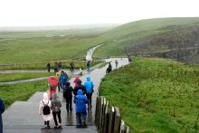
The weather was horrendous on arrival: heavy rain made worse by very strong winds. Use of an umbrella did not seem advisable, so I wrapped myself up as best I could in rainproof gear. I made it to the Visitor Centre and went inside for some respite, and to see pictures of what the cliffs were supposed to look like. Outside again, it was a case of: head down, take a few steps, glance ahead, repeat. Surprisingly, given the atrocious conditions, I managed to get some decent photos.
 |
 |
 |
 |
 |
 |
Next, I followed the road signs to the tiny coastal village of Doolin, before continuing to Doolin Pier, departure point for the Aran Islands. (This group of islands, spelt with a single 'r', is where the well-known knitwear comes from and should not be confused with the Isle of Arran in Scotland.) The same shocking weather continued unabated, but once again I somehow managed to get some reasonable photos.
 |
 |
 |
 |
 |
 |
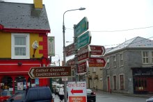
My next stop was at Lisdoonvarna, where the first priority was to eat some lunch at a local café prior to having a look around.
 |
 |
 |
 |
 |
 |
 |
 |
 |
Next up on my route was The Burren, a strange, rocky area that made me wonder if I was definitely still on planet Earth - at which point, all I had to do was observe the rain to settle the issue. I also stopped at Ballyvaughan, which looked as though it would have been very pretty in brighter conditions. At least it was only drizzling there.
 |
 |
 |
 |
 |
 |
| ABOVE: Driving through The Burren | ABOVE: Taking a final break at Ballyvaughan | ||||
| RIGHT: Dinner at the Harbour Hotel |
 |
 |
 |
After all that, I pressed on for an evening and overnight stop at the Harbour Hotel in Galway City, arriving shortly after 4pm. Despite the deeply unhelpful weather conditions and multiple soakings, I surprised myself by feeling that it had been, on balance, a successful day!
